Orbiting Carbon Observatory-2OCO-2
The principal science objective of the OCO-2 mission is to retrieve a global geographic distribution of carbon dioxide (CO2) sources and sinks. However, the OCO-2 mission does not directly measure CO2 sources and sinks. Instead, sophisticated computer-based data assimilation models that use column averaged dry air CO2 mole fraction (XCO2) data infer the location of these sources and sinks.
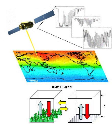
To get the representative values of XCO2, or the amount of CO2 in the measured space, the OCO-2 instrument measures, at a given location, the intensity of reflected sunlight off the Earth's surface at specific wavelengths. Gas molecules in the atmosphere absorb the sunlight at specific wavelengths. So, when light passes through the Earth's atmosphere, the gases that are present leave a distinguishing fingerprint that can be captured. The OCO-2 spectrometers, working like cameras, detect these molecular fingerprints. Then the absorption levels shown in these spectra, like a captured image, tells us how many molecules were in the region where the instrument measured. The OCO-2 measurement approach concentrates on gathering data near the Earth's surface, where almost all of the CO2 sources and sinks are located.
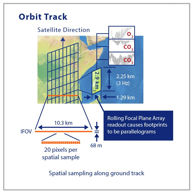
One of the challenges to get to these sources and sinks is that the light detected by the instrument must penetrate through all of the atmosphere. If you can picture the image of Earth from space, that image will always include white swirls over the land and ocean. The presence of clouds and optically thick aerosols or uneven terrain such as mountains can block the light and create an incomplete measurement of the complete atmospheric column. To reduce any uncertainties, the OCO-2 instrument acquires a large number of densely-spaced samples. Each sample covers an area of about 3 km2 when the instrument is looking straight down (nadir), along the spacecraft's ground track. The OCO-2 instrument can gather as many as 72,000 soundings on the sunlit side of any orbit. With measurement footprints of this size and density, the OCO-2 instrument acquires an adequate number of high quality soundings, even in those regions where clouds, aerosols and topographic variations are present.

Wavelength bands for CO2 and O2
To make sure that we have an accurate derivation of XCO2, we also do a comparative absorption measurement of a second atmospheric gas, oxygen (O2). The concentration of molecular oxygen O2 is constant, well known, and uniformly distributed throughout the atmosphere. Therefore, O2 is the best candidate for reference measurements. The O2 A-band wavelength channel, in the vicinity of 0.76 µm, provides the required absorption spectra. The O2 A-band spectra indicate the presence of clouds and optically thick aerosols that preclude full column measurements of CO2. Observations from this band are used to infer the total atmospheric pressure, as well as to measure the solar light path length as it passes through the atmosphere. OCO-2 mission designers selected three specific Near Infrared (NIR) wavelength bands – O2 (Oxygen) A-band, Weak CO2, and Strong CO2. The OCO-2 instrument measures intensity over all three of these bands at the same location on the Earth's surface simultaneously. Each of the three selected wavelength bands provides specific information to measurement accuracy. The weak CO2 band wavelength, in the vicinity of 1.61 µm, is most sensitive to the CO2 concentration near the surface. Since other atmospheric gases do not absorb significant energy within this spectral range, the 1.61 µm band measurements are relatively clear and unambiguous.
Last, but not least, the strong CO2 wavelength channel, in the vicinity of 2.06 µm, provides a second and totally independent measure of the CO2 abundance. The 2.06 µm band spectra are very sensitive to the presence of aerosols. The ability to detect and mitigate aerosol presence enhances the accuracy of XCO2. The 2.06 µm band measurements are also sensitive to variations in atmospheric pressure and humidity along the optical path. These variations in pressure and humidity have a known impact on XCO2.
OCO-2 flies in a polar, sun-synchronous orbit, providing global coverage with a 16-day repeat cycle. On each orbit, the Observatory path crosses the equator at approximately 1:35 PM local time. Acquisition at this time of day is ideal for spectroscopic observations of CO2 that use reflected sunlight, as the high sun maximizes the measurement signal-to-noise ratio. Furthermore, since XCO2 measurements tend to be near their daily average value at this time of day, the Observatory data will be highly representative of the region where they were acquired. Coordination of the orbit with the A-train facilitates carbon cycle science by integrating OCO-2 observations with those of other instruments that fly aboard the Aqua and Aura spacecraft. Among these measurements are the temperature, humidity, and CO2 retrievals from Atmospheric Infrared Sounder (AIRS), the cloud, aerosol and ocean color observations as well as carbon source and sink measurements from the Moderate Resolution Imaging Spectroradiometer (MODIS).
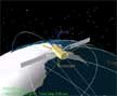
Animation of typical spacecraft maneuvers in nadir mode.
To enhance the quality and to verify the validity of mission data, OCO-2 collects science observations in Nadir, Glint, and Target Modes. In Nadir Mode, the satellite points the instrument to the local nadir, so that data can be collected along the ground track just below the spacecraft. Science observations are collected at all latitudes where the solar zenith angle is less than 85°. Nadir Mode provides the highest spatial resolution on the surface and is expected to return more useable soundings in regions that are partially cloudy or have significant surface topography. Nadir observations may not provide adequate signal-to-noise over dark ocean surfaces.

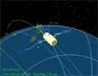
Animation of typical spacecraft maneuvers in glint mode.
In Glint Mode, the spacecraft points the instrument toward the bright "glint" spot, where solar radiation is specularly reflected from the surface. At high latitudes over the ocean, observations of the bright glint spot provide up to 100 times as much signal as measurements collected while looking straight downward at the ocean surface. Thus, the use of glint measurements significantly improves the signal-to-noise ratio over the dark ocean. Glint soundings are collected at all latitudes where the local solar zenith angle is less than 75°. The OCO-2 mission plans to alternate between Nadir and Glint Modes over sequential 16-day global ground track repeat cycles so that the entire Earth is mapped in each mode on roughly monthly time scales.
Animation of spacecraft maneuvers from nadir mode to target mode and back to nadir mode.
In Target Mode, the Observatory locks its view onto a specific surface location and retains that view while flying overhead. A target track pass can last for up to 9 minutes. Over that time period, the Observatory can acquire as many as 12,960 samples at local zenith angles that vary between 0° and 85°. The mission plans to conduct regular Target track passes over each of the OCO-2 calibration sites where the ground-based solar-looking Fourier Transform Spectrometers are located. Comparison of space-based and ground-based measures provides a means to identify and correct systematic and random errors in the OCO-2 XCO₂ data products.
Space-based measurements
Orbit tracks
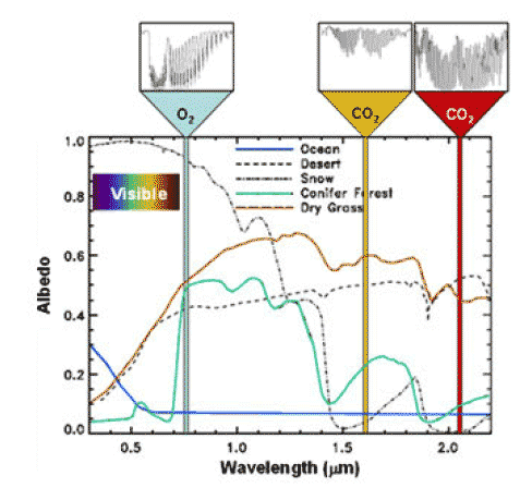
This diagram displays the spectral reflectance of common Earth surfaces at the wavelength of the three OCO-2 channels.